

PROTECT YOUR DNA WITH QUANTUM TECHNOLOGY
Orgo-Life the new way to the future Advertising by AdpathwayRide with GPS just released a couple of great new features. The first should help people plan their rides around fire conditions and check whether bikepacking routes are impacted. In addition, they also quietly rolled out waiver functionality for clubs, which could be useful for many bikepacking events. Read below to learn more…
Just as Neil discussed in his most recent video, wildfires and other burns are having a major impact on where and when we can safely ride bikes.
WILDFIRE LAYER
Fortunately, Ride with GPS has released a new layer for their web, iOS, and Android platforms to help us adapt to this reality. The new Wildfires Layer shows exactly where fires are burning so you can plan your bikepacking adventure around active and recent wildfires and prescribed burns. Combined with their previously released wind and air quality layers, riders should be able to make more informed decisions about where they want to ride to avoid dangerous situations, poor air quality, and interfering with first responders.
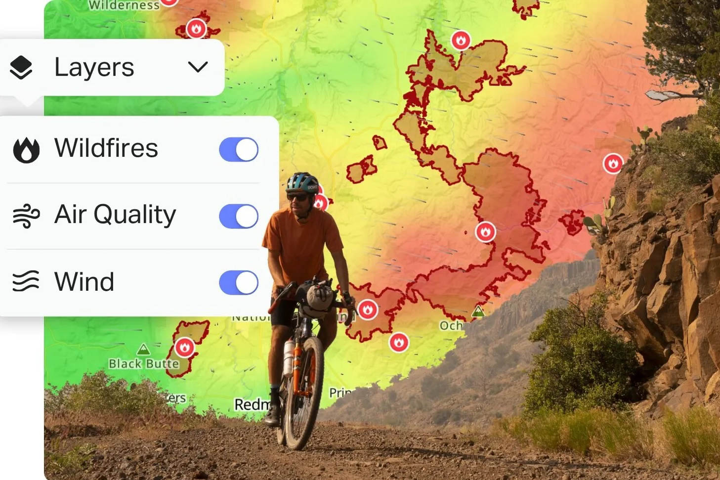
The Wildfire Layer shows active fire perimeters across the US and Canada and is refreshed every hour. We’ve already been using it here at BIKEPACKING.com as we wait out a fire closure so we can publish a fabulous new route. It also shows historical fires and burns from the last five years. Unfortunately, this functionality is not yet available outside those two countries.
Seeing where fires have burned before is just as useful as seeing what’s active today. It helps you understand which corridors tend to be at risk each season. Recently burned areas tend to be a lot more exposed, which is also useful to know beforehand.
The Wildfires Layer is available everywhere the “Layers” menu exists:
- Searching for and viewing routes
- Planning routes
- Recording a ride or navigating in the mobile app
- On Collections and Event pages
This is not yet available on our World Map, but you will be able to see it on the route when you open it in Ride with GPS. We also hope to have an updated World Map that will include this layer very soon.
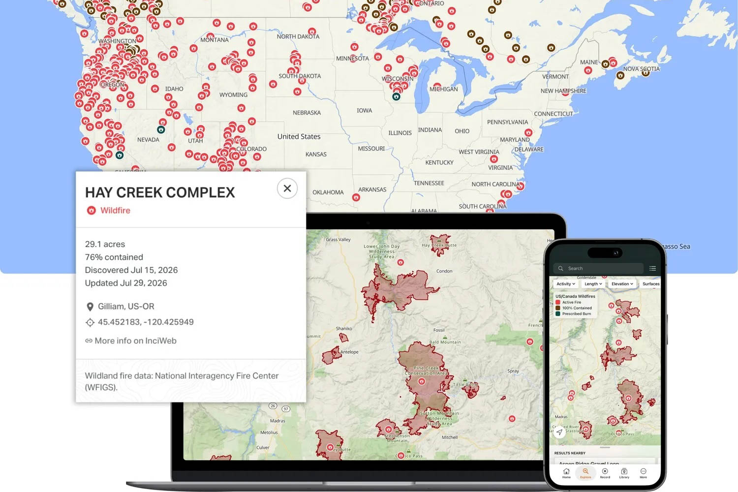
Ride with GPS recommends stacking your layers to have a well-rounded view of what may be coming your direction. A fire map alone tells you where things are burning.
Pair the Wildfires Layer with two others, and you get a more complete safety read:
- Wildfires tells you where a fire is, how big it is, and how contained it is
- Air Quality tells you what you’ll actually be breathing
- Wind tells you which direction the smoke is heading
With all three layers turned on, you’ve got a genuinely useful air quality index for cycling, not just a dot on a map. You can see a fire burning 30 miles away, check the wind, and know in seconds whether it’s headed toward your route or away from it.
Waiver Functionality
Ride with GPS also quietly rolled out a waiver functionality. This feature is designed for clubs, shops, and events, and it aims to make it easier than ever for ride leaders and event directors to accurately and consistently ensure each person has signed the appropriate form for the situation. As a former event director and outdoor recreation manager, I know the stress that legal liability can place on ride organizers. An improperly filled-out waiver is worthless, and a closet full of seven-year-old waivers is miserable to maintain. That’s what Ride with GPS is trying to solve.
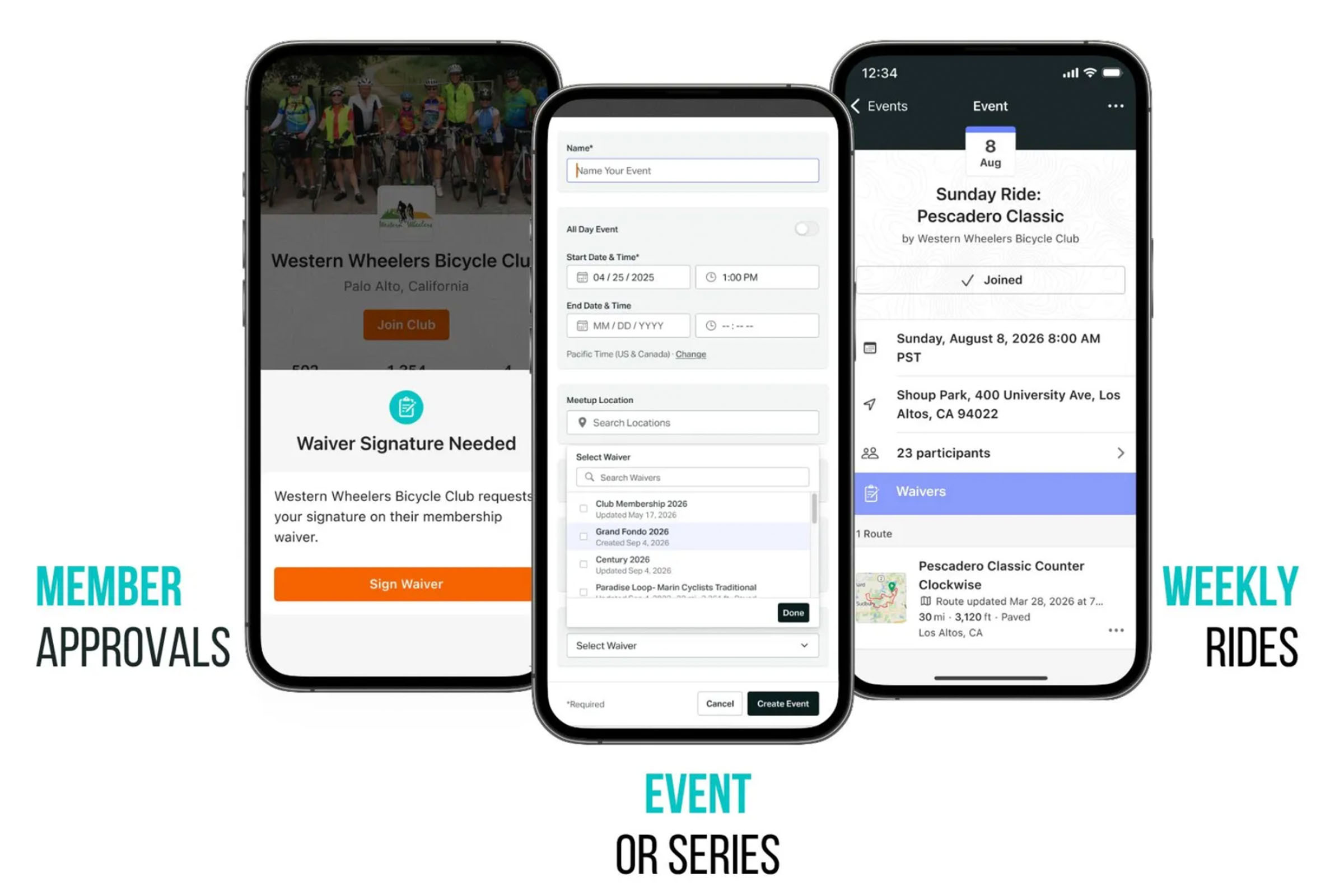
Shops or clubs can create initial waivers for riders to sign when they are invited to join a club, whether they participate in a ride or not. Organizers can also create event-specific waivers that can layer on top of the foundational waiver riders have already signed. The event waiver can also stand on its own for something like a shop ride or a bikepacking event. I can see this being useful for community events like summits where participants might sign a waiver for the entire three-day event but might also sign a more specific waiver for a ride on day two.
Organizers can use a waiver template provided by Ride with GPS, or they can upload their own language. Additionally, organizers will have a one-stop digital location for all signed waivers, personally relevant information like medical alerts, and contact information, including emergency contacts. There is a lot more information available about how waivers work and what they can do on the Ride with GPS website.
Please keep the conversation civil, constructive, and inclusive, or your comment will be removed.













 English (US) ·
  French (CA) ·